Shoreline Permit
Contact us before you do shoreline work
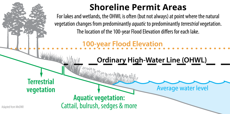
For lakes and wetlands, a permit is needed for most work that occurs below the Ordinary High-Water Line (OHWL) or the 100-year Flood Elevation. Typically the OHWL is located where aquatic vegetation changes to predominantly terrestrial or upland vegetation, but this isn't always the case. The 100-year Floodplain Elevation is a set elevation for each lake.
For information about the OHWL or 100-year Flood Elevation of a lake, please contact RPBCWD or the Minnesota DNR.
Shoreline Activities That Require A Permit
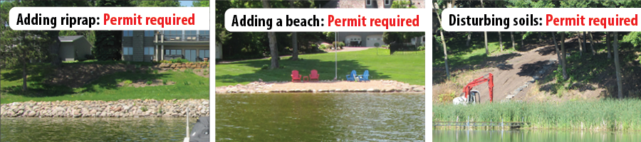
Below is sample of shoreline work that requires a permit. This list is NOT all inclusive. Contact RPBCWD to see if your proposed project requires a permit.
- Adding riprap, rocks, landscaping blocks, or other hardscaping
- Adding a beach (sand blanket)
- Disturbing soils (grading, excavating, adding soil, dredging, etc.)
- Building or expanding a structure such as a building or bridge
- Clearing upland/terrestrial vegetation near and along the shoreline.
- Control of most native aquatic plants (Minnesota DNR permit).
100-year Flood Elevations
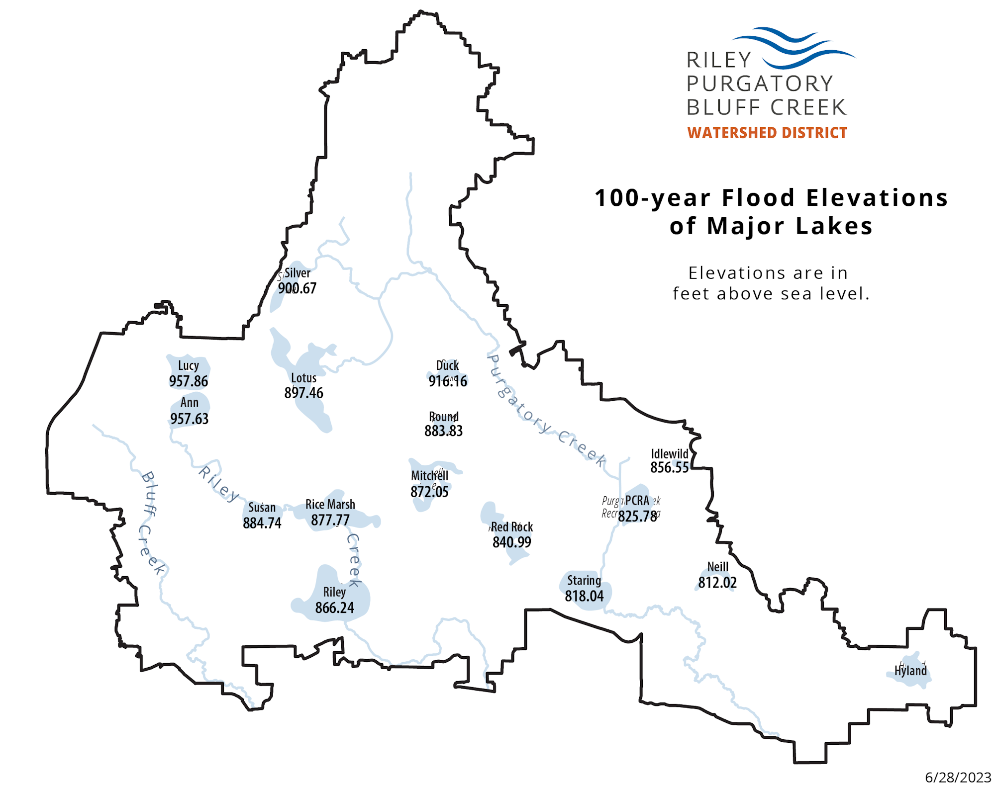
Every major lake within the watershed district has a set 100-year flood elevation.
Download a map of the major lake 100-year flood elevations or see the table below.| Lake Name | 100-Yr Flood Elevation |
|---|---|
| Ann | 957.63 |
| Duck | 916.16 |
| Hyland | 819.55 |
| Idlewild | 856.55 |
| Lotus | 897.46 |
| Lucy | 957.86 |
| Mitchell | 872.05 |
| Neill | 812.02 |
| Purgatory Creek Recreation Area | 825.78 |
| Red Rock | 840.99 |
| Riley | 866.24 |
| Rice Marsh | 877.77 |
| Round | 883.83 |
| Silver | 900.67 |
| Staring | 818.04 |
| Susan | 884.74 |
Resources
Flood Maps
Use the FEMA Flood Map Service Center to find a flood map.
Minnesota Department of Natural Resources - Permitting
Beach Blanket (pdf)- Water Permits (external link) - Includes "Do I need a permit?", information about aquatic plant control, lake aeration, and more
- Shoreline Alterations Information Sheets
- Aquatic plant management and permitting
